Roosevelt Mining Claim Contact Gold Rush Expeditions
Use code JRM1003 for a 10% discount.
www.goldrushexpeditions.com
Ph: 385-218-2138
Email: goldrush@goldrushexpeditions.com
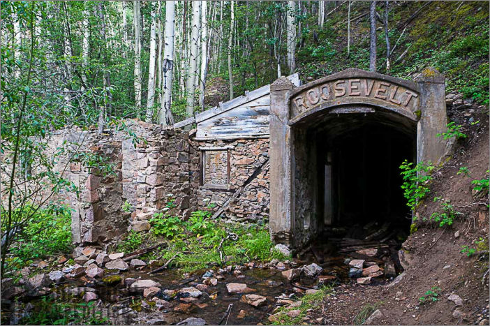
The Roosevelt Mining Claim is located in the Gold Brick District, east of the Camp Bird Mine. The mine is one of less than a handful of properties left in the United States with such an intact mine camp, masonry work, and extensive, intact workings. The property contains a large span of riverfront which originates far past the town of Pitkin and Ohio city, washing the dumps and tails of many massive mines. Black sands containing small grains of gold are found throughout the river and a surveyor in 2016 reported finding a .7 oz. nugget while panning samples.
The mine is cut on series of small fissure veins said to contain bits of free gold along with copper and some galena. A key element of the mine, beyond the various veins with various material that are encountered in the underground workings, is the undefined workings and potential.
 The Roosevelt tunnel, while started as a small gold mine, was acquired and funded as a portal to intercept a series of vertical vein said to be at least 800 in length containing appreciable amounts of native gold.
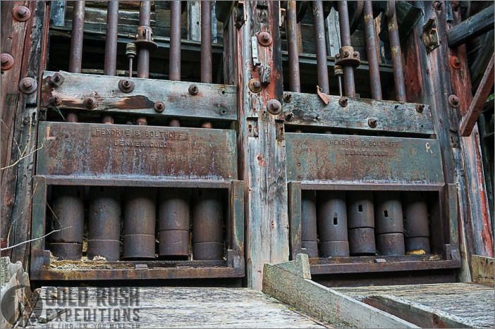
The mine was cut for dual purpose. The first being to de-water the Camp Bird Mine to the east of the Roosevelt. The second was to provide access to the veins and provide a simple method for shipping. There is a large dual battery (10 stamps) mill at the property which has processed a substantial amount of material. The tailings from the crusher are estimated at 10,000 tons.
Waste dump from the portal is difficult to measure as much is dumped into the river and heavy flood seasons have no doubt washed away a lot of material. With that in mind, there are an estimated 55,000 tons of waste dump on the property.
 The mine has restricted access since 1940 according to local accounts. The bridge which spanned the river and much of the electrical power station equipment was taken for use in the WWII efforts. The site is not readily visible from the county road, and access is only gained by a short, but steep hike to the mine camp site.
There is quartz, copper, and some silver visible in the waste dumps. The mine is known to have produced good gold values of $40-50 per ton (2-2.5 oz Ton) prior to 1919.
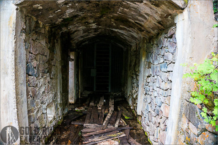
There is considerable water discharge from the mine which is routed and channeled to the 3800 mark. A split in the drifts at 3800 shows a small damming in a drift that runs generally eastward. There is approximately 20 inches of water in this drift and it continues for an unknown distance into the mountain. This drift is thought to lead to the aforementioned vertical veins. The mine was reported as dry up into 1919 when the last documented work was completed. The presence of water indicates that later work done likely intercepted the Camp Bird Mine workings and is draining that working.
 The mine is largely a gray slate host rock throughout except for where the mineral veins are encountered. These veins are largely quartz with iron, gold and some copper based minerals. There are various short drifts in the workings that begin some exploration of the veins but none were surveyed that were developed to any extent. With that in mind, surveyors terminated a survey in 2016 at the 3800 mark when the oxygen levels dropped to 13%. There was reportedly substantially more development that could not be addressed without supplemental oxygen. This also indicates that there is no current pass through the mountain that would allow air to flow through. This condition should be mediated prior to any work being carried out in the workings. A series of fans with standard duct work would likely suffice.
The shell of a power plant exists below the mine workings and was in use up to 1932 to power the mine camp and the crusher. There is substantial build-up of black sands and gold bearing material in and around this structure which is directly in the river (which is used to produce electricity).
The mine will require some investment and permits to be put into a working state. There is a series of good roads on the claim, however, a bridge will need to be built to access these roads.
 Waste dumps and tailings were sampled and assayed as shown below. Despite excellent vein showings, there were no samples taken inside the workings.
The mine is located in an extremely sensitive historical area, for the preservation of the site integrity, there will be no site visits except by qualified individuals.
Contact: Gold Rush Expeditions
Use code JRM1003 for a 10% discount.
www.goldrushexpeditions.com
Ph: 385-218-2138
Email: goldrush@goldrushexpeditions.com


