East Golden Mining Property Nevada Contact Gold Rush Expeditions
Use code JRM1003 for a 10% discount.
Terms and Conditions apply.
www.goldrushexpeditions.com
Ph: 385-218-2138
Email: goldrush@goldrushexpeditions.com
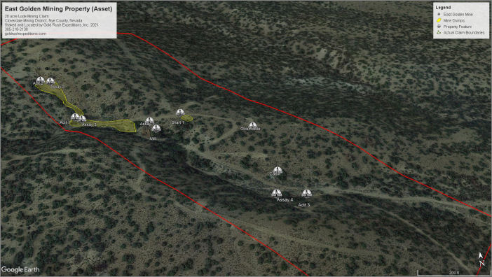
The East Golden Mineral property consists of a single 20-acre lode Mining claim. The property is located in the Cloverdale Mining district, within the Golden sub-district. So named for the East and West Golden Mineral sites and the town of Golden that grew to support the sites. The town of Golden was a small mining town that serviced miners and ranchers from 1898-1944. The town was leveled in 1966 and wildfire in 2008 destroyed all but the building foundations.
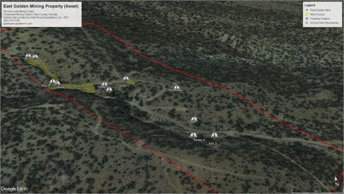 Development of the property consists of at least 3 adits cut into country rock (rhyolite). The workings that have not been backfilled are stable and competent. They are noted as follows:
1. The lower adit (adit 1) will require some clearing as rock was pushed in front of it as part of a reclamation action in 2016. This has led to dirt and slough from above being fed directly into the adit, filling roughly 3 of loose dirt into the adit.
2. The upper adit (adit 2) is also cut into stable, competent host rock. The workings are in excellent condition and can be examined from portal to face without any concerns
3. There was a shaft located just behind the old mill. This has been reclaimed and will require excavation to re-open.
4. The last adit (Adit 3) is farther removed from the rest of the development, being a few hundred feet east of the main workings, but a short distance from the mining camp. This portal is again, cut into country rock and is stable and in good condition.
Quartz and vein material is noted in Adit 1 and Adit 3
Gold is formed in quartz veins within country rock (rhyolite). The lower portal is cut on a fault which exposes several quartz veins that are 2-3 in width. There is a substantial amount of breccia that is soft in some area. Native gold is visible within the quartz veins only, but reportedly is found within the breccia. This is further reinforced by years of placer mining operations that have successfully operated below the East Golden.
 The origin of the location of the deposit is not known. United Verde held title to the property from 1902(?) to 1921. Their mining engineers assayed gold values at the property ranging from 2.2 ounces per ton to only a trace . The most valuable and highest assays were reported as quartz veins with iron staining and some visible gold flake. Exxon acquired the property in the early 1970s and was conducting geophysical work in 1985 . The result of which has not been disclosed to public.
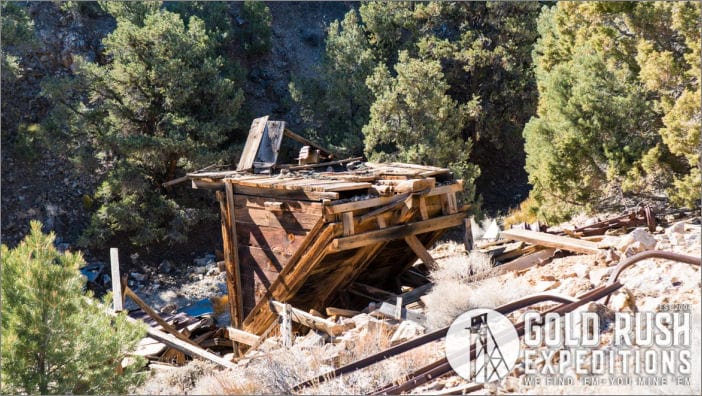
There is the remnant of a small mill on the site. This appears to be a simple crush and table mill. There is only a small number of tailings, estimated at 360 tons. The tails consist largely of quartz and little else. Much of the tailings have washed into a runoff below the mill, so there may have been more tailings 100 years ago. The mill is reported to have been operational in 1920 and also in 1942.
 There is also remnant of a small mining community, consisting of a few stone cabins and storage buildings. This is indicative of the property being valuable enough to have miners or foremen living on site. Tingley, in 1985, incorrectly reported development at the site as failures, citing Krals 1951 report which discusses the amount of gold that was easily recovered at the site and makes no mention of success or failure of the operation.
The property contains free gold in narrow veins according to historical reports. Surveyors in 2021 located some visible gold in waste dumps at the site. The gold bearing veins are exposed through a series of drifts and shafts. Veins in the upper tunnel were documented.
Assays returned an average value of 1.14 oz. gold per ton. An extremely high value for a small, largely undeveloped property.
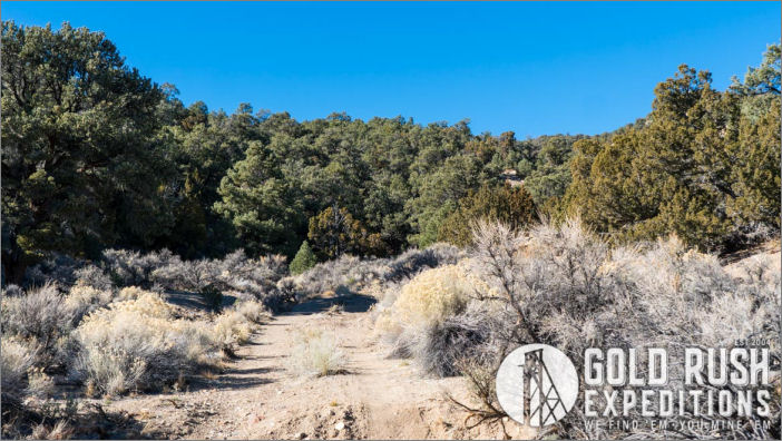
The East Golden Mine is north of Tonopah, Nevada. There is excellent access to the property via 4WD roads. 4WD is not required to access the site in dry conditions. All roads are on US Forest Service, US Bureau of Land Management or established RS-2477 routes. There are no issues with private properties. The roads are wide enough for small vehicles but would require work to handle larger equipment or dump trucks.
 The portals to the Upper, Main and Exploratory adits were gated by the US Forest Service in 2016. Gold Rush Expeditions, Inc. holds the keys to the gates, these keys will be transferred only upon receipt of executed quit claim deed.
Contact: Gold Rush Expeditions
Use code JRM1003 for a 10% discount.
Terms and Conditions apply.
www.goldrushexpeditions.com
Ph: 385-218-2138
Email: goldrush@goldrushexpeditions.com

