Historic Astrologer Gold Mine
220 Acre Lode Claim Burro Mountain Mining District
Grant County, New MexicoContact Gold Rush Expeditions
Use code JRM1003 for a 10% discount.
www.goldrushexpeditions.com
Ph: 385-218-2138
Email: goldrush@goldrushexpeditions.com
Gold Rush Expeditions, Inc. is proud to present the Historic Astrologer Gold Mine. This is a 20 acre lode mining claim for sale exclusively through Gold Rush Expeditions, Inc. The Astrologer Gold Mine is located just outside of Silver City, New Mexico and has been properly staked and marked at all corners. All Gold Rush Expeditions, Inc. claims have been meticulously surveyed, mapped and researched. Field work is completed by our own experienced, well versed Mine Survey Team.
The Astrologer Gold mine is a well documented producer of gold and silver. Native gold was observed and noted in the waste dumps by onsite surveyors in 2016.
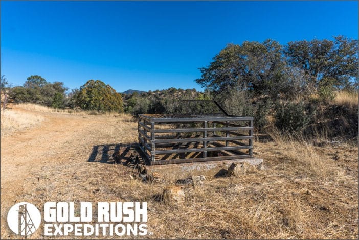
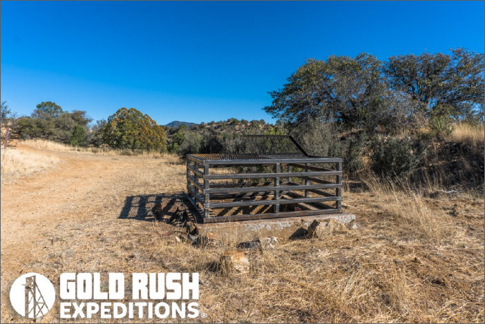
 The Astrologer Gold Mine claim covers 2 large shafts estimated at 120' and 100' respectively. These shafts reportedly have a good number of drifts exploring the veins. The upper shafts are cut on an outcrop and there is a large open stope assumed to interconnect that is 100' below these shafts and accessed by a decline adit. The shafts have recently been gated with wide access ports. The shafts were collared with concrete and once had headframes over them.
The Astrologer Gold Mine is located near the historic mine town of Silver City, New Mexico. Good 4WD roads lead directly to the claim and provide excellent access. Surveyors assessed that there were other mine entrances on the claim at one point in time but they have been bulldozed. Solar pump functional and drawing water from the mine into a holding tank and into a trough, most likely from a local rancher. This will not impact the mining activity on the claim.
This is a good property for a small mining operation. A Notice of Operation will be required to access the shafts and sample the workings. The claim could also be worked without notice by addressing the waste dumps for gold. To make a decent return from the operation it is recommended that the shafts be sampled and high graded.
Gold Rush Expeditions, Inc can provide assistance with Notice of Operations and submissions if needed.
 History of the Mines
From a 1964 report
The Astrologer Gold mine, in the SW¼ sec. 20, T. 19 S., R. 16 W., on the west side of the Big Burro Mountains, is owned by Charles Ray, Lordsburg. The mine has been in¬active for many years but at one time was worked for silver, gold, and lead. Two vertical shafts on separate veins explore the deposit. Six drifts, none exceeding 75 feet, extend from the shafts.
The ore concentrations occur in several subparallel quartz veins which cut Burro Mountain granite. The veins are almost vertical and strike northeasterly. Short andesite and more continuous rhyolite dikes also trend northeast. Numerous aplite and pegmatite dikes intrude the granite in the vicinity. A prominent rhyolite dike, which can be followed for more than four miles, trends northwestward 1000 feet west of the mine. Minerals identified on the dump include chalcopyrite, pyrite, galena, chalcocite, and quartz.
Two small lead-silver prospects lie northwest of the Astrologer Gold mine. Neither has been active in recent years. Both have been explored only by shallow pits. The Live Oak prospect, owned by N. P. Grenfell and H. R. Eaton, Silver City, is in the NE¼ sec. 19, about 3000 feet northwest of the Astrologer Gold mine. Two 15- to 20-foot-deep shafts expose a northwest trending vertical quartz vein about one foot thick cutting the Burro Mountain granite. Pods and granular masses of galena, sphalerite, py¬rite, and quartz less than four inches long occur within the vein. Pol¬ished-section studies of the ore by Hewitt showed that the sphalerite was deposited in small cavities lined by quartz druses and contains tiny blebs of random- or parallel-oriented chalcopyrite.
A similar vein lies about midway between the Live Oak and the Astrologer Gold Mine. It is exposed in a shallow trench.[1]
Reference:
1. Gillerman, Elliot. Mineral Deposits of Western Grant County, New Mexico. 1964
Contact: Gold Rush Expeditions
Use code JRM1003 for a 10% discount.
www.goldrushexpeditions.com
Ph: 385-218-2138
Email: goldrush@goldrushexpeditions.com


